

GARY MULROONEY
The evolution of landscape and climate at the Brú na Bóinne World Heritage Site
Supervised by:Dr. Stephen Davis, UCD School of Archaeology
 Project Overview
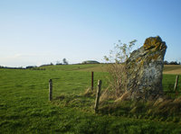
My research examines long-term climatic and landscape evolution in a critical area of Ireland’s archaeological heritage, the World Heritage Site (WHS) at Brú na Bóinne, Co. Meath. The project will explore the nature of cultural activity in the landscape over the Mesolithic and Neolithic periods, through a focus on landscape and land-use reconstruction using environmental archaeological approaches. The project is multidisciplinary in that it incorporates elements of archaeology, physical geography and climate change science, and addresses a key site in Ireland’s archaeological heritage with a focus on a critical stage in the development of the Brú na Bóinne landscape, and the adoption of agriculture.
This research will allow the reconstruction of both the palaeoenvironment and palaeoclimate of the region, and so for the first time place the WHS within a sound environmental and climatic context. This area is vitally important for models of Mesolithic and Neolithic cultural change in relation to changing environments in northwest Europe, and the development of a palaeoenvironmental model will allow greater comparability to other important landscapes in a broader European context.
Key Research Questions
In developing a detailed palaeoenvironmental framework for the region this proposal will help address a number of key research objectives of the WHS Research Framework, Consultation Document:
- When did people first come to the Brú na Bóinne landscape and what was the nature of this first presence?
- What was the nature of the activity in Brú na Bóinne during the later Mesolithic?
- When did the transition to farming take place in Brú na Bóinne and how is it characterised?
Additionally the methodology will allow the construction of a palaeoclimatic framework, highlighted as a key research priority in better understanding the adoption of agriculture in Ireland in early prehistory.
Methodology
-
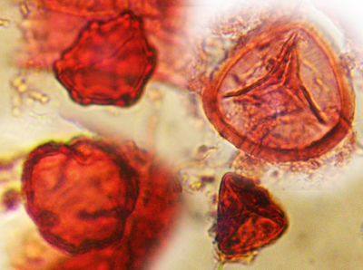
Targeted high-resolution pollen analysis, informed by radiocarbon dates, to provide a number of complimentary records of landscape evolution at critical time points throughout the area of the WHS.
-
Loss-on-ignition analysis.
- Pollen-based landscape modelling.
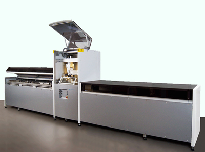
- Itrax Core Scanning to locate datable tephra horizons within lake deposits and possible early indicators of agricultural activity within the Brú na Bóinne region.
- Dr Thomas Kador
- Dr Ciaran O'Scea
- Dr Catherine Morris
- Dr Siobhan Byrne
- Dr Neil Fleming
- Dr Jim MacPherson
- Dr Laura McAtackney
- Dr Stefanie Lehner
- Dr Susan Cahill
- Dr John O'Neill