IMPACT CASE STUDY

Planning for sustainability through Environmental Sensitivity Mapping

  • 8 March 2021
  • Associate Professor Ainhoa González
  • Academic, Educational, Environmental, Political, Social, Technological


Summary

Sustainable development involves including environmental considerations in decisions about land-use. To facilitate this, Associate Professor Ainhoa González and her team have developed a new Environmental Sensitivity Mapping tool, supporting informed and sustainable land-use planning in Ireland.

Planning departments in the government and local authorities, as well as environmental consultancies and NGOs, routinely use the tool to examine and understand various environmental, societal and economic issues, informing the preparation of national, regional and local land-use plans. This freely available tool saves weeks of effort by dedicated planning teams. By improving decision-making around sustainable development, the tool has helped protect the environment and reduce land-use conflicts.

Research description

Environmental sensitivity maps, such as those in the images below, show how vulnerable different areas are to change. An area’s vulnerability is calculated by examining various factors:

  • Natural assets, such as protected habitats and sources of drinking water
  • Risks, such as flooding
  • Public opinion, such as the value placed on protected habitats, or concerns around drinking water quality and flooding

Ultimately, environmental sensitivity maps highlight areas where development (e.g. urban or industrial expansion) will likely result in significant adverse effects on the environment. They provide the basis for informed decisions in support of sustainable development, guiding development to the right location and helping reduce land-use conflicts and environmental impacts.

Dr González’s research looked at opportunities for a more proactive and participative integration of environmental considerations into land-use planning using Geographic Information Systems (GIS). Through this work, Dr González created a new way of mapping environmental sensitivity. This approach responds to the requirements of European legislation to assess the environmental impacts of development actions, in order to avoid or mitigate them.

To help ensure the tool is actually used to inform decisions about land-use, Dr González and her team developed a publicly accessible online mapping tool (www.enviromap.ie), supported by funding from the Environmental Protection Agency. The user-friendly and interactive tool has been incorporated into the national data web portal GeoHive. Anyone, not just planners, can now examine environmental, societal and economic considerations at local and regional levels, and create environmental sensitivity maps that incorporate their concerns and opinion. This supports transparent and accountable decisions across the Irish planning system.

I would consider the ESM tool to be one of the most notable innovations in recent years in upskilling planners to properly and thoroughly embrace environmental considerations at the heart of the planning process, building more sustainable and more robust planning policies for the future.

— Niall Cussen, Planning Regulator & Chief Executive, Office of the Planning Regulator

Research team

  • Ainhoa González (UCD – Project Lead)
  • Justin Gleeson (All-Island Research Observatory)
  • Eoghan McCarthy (All-Island Research Observatory)
  • Cristina Kelly (UCD)
  • Anna Rymszewicz (UCD)
  • David Jordan (UCD)

Collaborators

Project contributors
  • Tadhg O`Mahony (EPA)
  • Tara Higgins (EPA)
  • Maria Byrne (Ordnance Survey Ireland)
  • Maria Byrne (Ordnance Survey Ireland)
Project management
  • Eamonn Merriman (EPA)
  • DorothyStewart (EPA)
  • Cecilia Hegarty (EPA)
Other collaborators
  • Paul Scott (Department of Housing, Local Government and Heritage)
  • Gerry Clabby (Department of Housing, Local Government and Heritage)
  • Gemma Weir (National Parks and Wildlife Service)
  • Cian O’Mahony (EPA)
  • Bernie Guest (Waterford County Council)
  • John McCann (Sustainable Energy Authority of Ireland)
  • Saeed Khan (RPS Europe)
  • Des Cox (EirGrid)

Funding

  • EPA

Research impact

The environmental sensitivity mapping approach developed by Dr González and her team has changed environmental assessment and planning practices in Ireland. The methodology and associated online tool are routinely used to incorporate environmental considerations into the preparation of land-use development plans. Many practitioners across the country have benefited from the tool (see testimonials below).

Policy impact

The methodology was published as guidance by the EPA in 2009. Since then, planning departments in the government and local authorities, as well as environmental consultancies, have used it when preparing more than 40 land-use, energy and tourism plans (such as the Wild Atlantic Way, the Offshore Renewable Energy Action Plan, and the Clare County Development Plan).

The related online tool was launched in October 2019, and has been used by policymakers when preparing Project Ireland 2040 – National Planning Framework, and the Regional Spatial and Economic Strategies, that guide development at county and local levels. Currently, the tool is being used by local authority planning departments in the review of county development plans. The National Planning Framework acknowledges how the web tool was used to support informed planning:

“In preparing the NPF, an Environmental Sensitivity Mapping (ESM) tool was used in the SEA and environmental assessments. ESM is a method for identifying at a strategic level, environmentally sensitive areas and to help inform cumulative and in-combination effects on the environment. It also provides a visual overview of the relative sensitivity of areas, particularly where they overlap, in order to provide a more strategic and informed approach to planning”
— National Planning Framework, Government of Ireland, p. 155

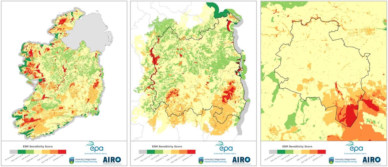
Environmental impact

By highlighting the location of natural assets, their overlap and vulnerability, the tool provides immediate and objective information to guide development to suitable areas for environmental protection. In doing so, it places the environment at the centre of decision-making and prevents land with significant natural value from being zoned for development.

Technological impact

Before the online tool was published, environmental sensitivity mapping required GIS skills and expertise, and weeks of time and effort by a dedicated team, to gather and analyse data from a wide range of sources. This made it difficult for planners, stakeholders and the general public to scrutinise the information.

The tool overcomes these technological barriers by enabling centralised, interactive and user-friendly access to over 120 national spatial datasets. Anyone can examine environmental and socio-economic considerations, and map environmentally sensitive areas to inform decisions as to what development should happen where. The tool saves time, resources and money by making relevant data readily available to all, and producing sensitivity maps in a matter of minutes.

Social impact

The tool raises environmental awareness (for example by providing easy access to local information about natural resources), and fosters participatory planning. Users can define environmental criteria, and incorporate public concerns in the form of weights that emphasize the relative importance of selected criteria, to create context-specific sensitivity maps. In this way, it enables more environmentally inclusive, participative and transparent planning and decision-making.

Educational impact

The project team has trained over 120 Irish planners and environmental consultants in the use of the environmental sensitivity mapping approach. Capacity building workshops will continue over the coming months. The tool is also used by students across UCD Schools (including Agriculture and Food Science; Architecture, Planning and Environmental Policy; and Geography) to learn about environmental assessment.

Academic impact

The methodology has influenced environmental assessment research and practice around the world. The tool – first of its kind – has been called “a great reference in the field of online geodatabases supporting decision-making and environmental assessment” (international reviewer, Environmental Impact Assessment Review).

“The benefit of the ESM tool is that it enables a breaking down of the traditional compartmentalisation that can occur between different technical teams involved in the planning process… enabling a more creative and adaptive approach that can be brought into the heart of the decision-making process and deployed to explore different scenario’s and policy responses, even within a live consultative or decision-making process.”
— Niall Cussen, Planning Regulator & Chief Executive, Office of the Planning Regulator

“The Environmental Sensitivity Mapping (ESM) Webtool has proved to be a great addition to the GeoHive platform, Ireland’s geospatial data hub … ensuring that all assessments are conducted against the authoritative, core reference data. The tool has seen a large number of users visit the GeoHive site, particularly from Local Authority planners and we hope it continues to have such a positive impact.”
— Hugh Mangan, General Manager of Business & Marketing Ordnance Survey Ireland

“By providing a way of visualising and interrogating a large number of environmental data sets it enables planners and other practitioners to understand the environmental consequences of different land-use choices and can therefore help plan-makers to draft better plans. Because it’s easy to use it can be used by a wide range of participants (including the public), enabling a better understanding of key environmental issues when plans are being formulated.”
— Gerry Clabby, Head of Ecological Assessment, Department of Housing, Local Government and Heritage

“This is a novel, nationally-important decision support tool for Strategic Environmental Assessment and planning processes in Ireland … for a more informed approach to spatial planning and development with the environment at the centre of decision-making. There is currently nothing else like it in Ireland. The tool represents an excellent example of how high quality applied research can deliver practical and innovative solutions to enhance environmental protection.”
— Dr Tara Higgins, Senior Scientific Officer, Environmental Protection Agency

“The Environmental Sensitivity Mapping tool is a fantastic resource for the Local Authority sector particularly in informing pre-planning applications for major developments and also from a Forward Planning perspective where overall sensitivity is required to focus the direction of Plans and Strategies. It may actually provide a more sensitive and robust output to that of the standard approach.”
— Sheila Downes, Environmental Assessment Officer, Clare County Council

“A very robust tool which environmental assessment and planning processes definitely benefit from. We have used it to support SEA on a number of plans since its launch, including the Regional Spatial and Economic Strategies, and we regularly recommend it to clients and colleagues as a tool to assist their decision making.”
— Antonia Gaughran, Technical Director - Environment, RPS Group

“We used the ESM tool to develop an ‘environmental profile’ and inform the decision making on key settlements. The tool is particularly good for rapid data visualisations of regional indicators to inform environmental scoping exercises and inform the development of planning alternatives.”
— Nicci Nolan, Senior Executive Planner, Eastern and Midlands Regional Assembly

“The Environmental Sensitivity Mapping tool is a unique development which provides important environmental information at a high resolution for the entire country in an easily accessible way for everyone. With regards to the comprehensiveness provided, there is currently nothing comparable available in the UK and I cannot think of any country that provides the same environmental information in an area-wide manner.”
— Prof Thomas Fischer, Director, Environmental Assessment and Management Research Centre, University of Liverpool

“The ESM webtool brings a much-needed spatial perspective into environmental assessment and planning, enabling to visualize and understand the distribution of environmental stressors and receptors, and their interactions. It is very solid tool that can inform several stages of the SEA and planning processes, as well as design of suitable land-use development options.”
— Assoc Prof Davide Geneletti, Author of ‘Multicriteria Analysis for Environmental Decision-Making’, University of Trento, Italy


Website

Academic publications

González, A, Kelly, C and Rymszewicz, A (2020). Advancements in web-mapping tools for land-use and marine spatial planning. Transactions in GIS, 24, 253-267. DOI: 10.1111/tgis.12603

González, A, Gleeson, J and McCarthy, E (2019). Designing and developing a web tool to support Strategic Environmental Assessment. Environmental Modelling & Software, 111: 472-482. DOI: 10.1016/j.envsoft.2018.10.014

Gonzalez, A and Enríquez-De-Salamanca, Á (2018). Spatial multi-criteria analysis in environmental assessment: A review and reflection on benefits and limitations. Journal of Environmental Assessment Policy and Management, 20(3), 1840001. DOI: 10.1142/S146433321840001X

González, A (2017a). A conceptualisation framework for building consensus on environmental sensitivity. Journal of Environmental Management, 200: 114-122. DOI: 10.1016/j.jenvman.2017.05.061

González, A (2017b). Mapping environmental sensitivity: A systematic online approach to support environmental assessment and planning. Environmental Impact Assessment Review, 66: 86-98. DOI: 10.1016/j.eiar.2017.06.010

Research reports

Project report: González, A, Kelly, C, Gleeson, J and McCarthy, E (2019). Developing and testing an environmental sensitivity mapping webtool to support strategic environmental assessment in Ireland. Ireland: Environmental Protection Agency https://www.epa.ie/pubs/reports/research/tech/research278.html

Guidance on the ESM methodology: González, A (2017). GISEA manual: Improving the evidence base in SEA. Ireland: Environmental Protection Agency. http://www.epa.ie/pubs/advice/ea/giseamanual.html