About
What is Spectral Imaging?
What is spectral imaging?
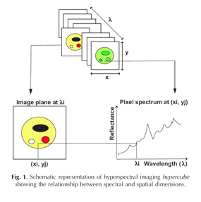
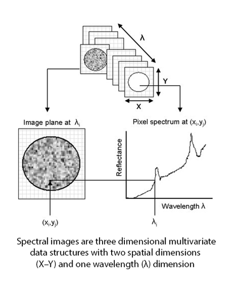
Spectral Imaging goes beyond the capabilities of conventional imaging and spectroscopy by obtaining spatially resolved spectra from targets at spatial resolutions varying from the level of single cells up to macroscopic objects. It was originally developed for remote sensing applications utilizing satellite imaging data of the earth, moon, and planets, but has since found application in such diverse fields as agriculture, pharmaceuticals and medical diagnostics. Each pixel in a hyperspectral image contains a spectrum representing the light absorbing and/or scattering properties of the spatial region represented by that pixel. The resulting spectrum acts like a signature, which can be used to classify or estimate composition of the material it represents. These hypercubes are data rich: for example, a typical hyperspectral imaging system with spatial resolution of 580 × 580 pixels will generate 336,400 spectra in a hypercube, each with > 100 wavelength variables. In order to extract useful information from these data structures we use a branch of mathematics called “chemometrics”. Read more about spectral image analysis and application areas at the links below.